
TID #1
Now that I've described TIDs, let's talk about each one (an insomniac's best medicine). The first one, TID 1, will end with a mystery I've yet to solve, but I'll figure it out eventually.
The picture shows the area of the TID. Northwestern Ave runs through the middle of it. V is the boundary to the west.
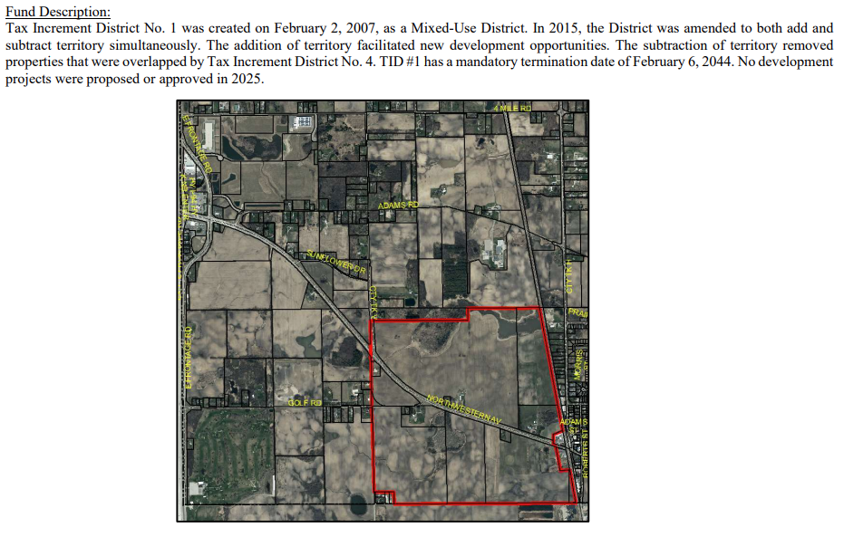
It was bigger up until 2015 when the properties to the west were moved into TID 4, so I'll just focus on what has happened to it since 2015.
With the redrawing of boundaries in 2015, an updated plan for revenues and expenses was published. The final goal of the TID was to produce $81M in new valuation. In 2015, the forecast called for new construction totaling $11.5M in each year from 2019 to 2025.
Try as I might, I cannot find any development within that boundary. Ever.
Now for the weird part. The financials at the end of 2023 show that from date of creation there has been $830K in tax increments, which can only come from tax on improvements since the creation of the TID.
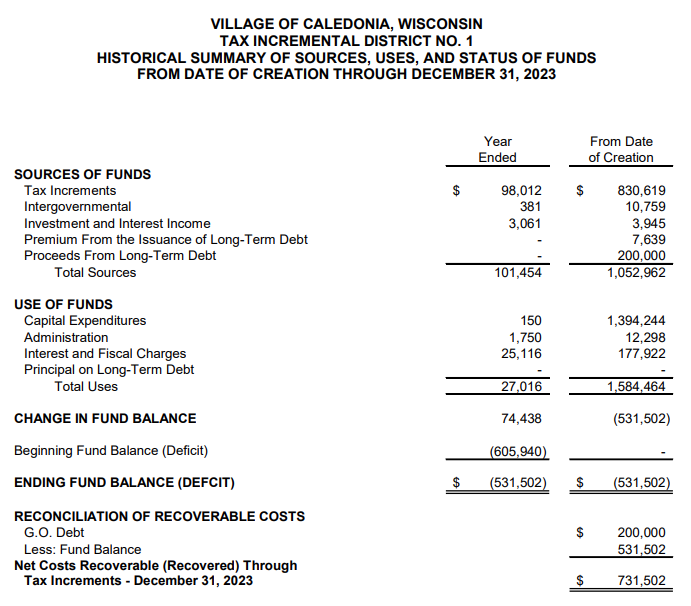
On the expense side, the TID shows $1.5M in capital expenditures, administrative, and interest charges on debt incurred.
All told, this TID has $731K of costs still to be recovered. That is, the tax increments of about $100k per year, wherever they are coming from, still have several years to go before the TID is paid off and that extra tax revenue makes its way to the general fund.
The unsolved mystery is how does a TID with no development in it generate $100k/yr in tax increment? All I can guess is some weird accounting when the boundaries were changed in 2015.
No matter how that gets explained away though, the village's first TID clearly falls in the failure bucket. Zero development against a forecast of $81M. Non-zero public expense for something. 18 years and counting.
On to the next one…